BHCCFWG is a community-based collaborative of citizens, businesses, organizations, governments, and landowners who share a vision for a sustainable future of our communities and the surrounding landscape.
About
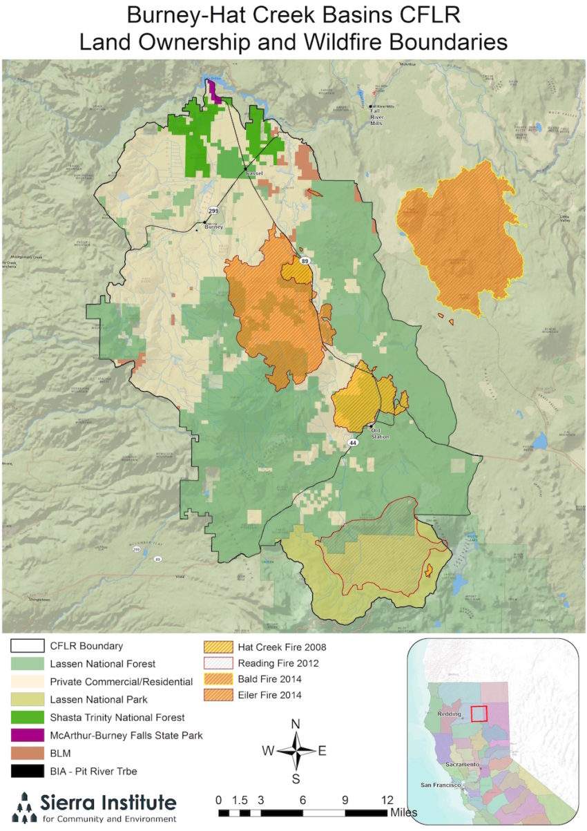
Founded in 2009, the Burney Hat Creek Community Forest and Watershed Group (BHCCFWG) is a collaborative forestry effort dedicated to improving social, environmental, and economic conditions in the Burney Creek and Hat Creek watersheds. The collaborative footprint encompasses 364,250 acres of public, private, and Tribal lands, and the communities of Burney, Johnson Park, Hat Creek, Cassel, and Old Station. In recent decades, local communities have experienced high rates of unemployment and increased risks of high-severity wildfires, issues the collaborative actively works to mitigate. The group's vision is to create a fire-resilient forest ecosystem with sustainable populations of wildlife, fisheries and habitat, functioning and restored watersheds and water quality, protected cultural resources and appropriate recreational opportunities while also helping to support quality of life, jobs for diverse community members, and economic benefits in local communities. BHCCFWG receives federal support through the U.S. Forest Service’s Collaborative Forestry Landscape Restoration (CFLR) program, augmenting available local resources to advance landscape-scale fuels reduction and forest health projects through coordinated public-private efforts.
Group Origins
The formation of the BHCCFWG stems from the Shasta Resource Advisory Committee (RAC), which first met in early 2008 to allocate renewed Title II program funds through a local grant program. The program supported a variety of small-scale projects, yielding a number creditable outcomes. However, some on the committee felt there was opportunity to increase the efficiency of the funds by funding a larger project that met the objectives of the statute to create jobs, develop economic stability for rural communities and stability for payment of counties, while also maintaining objectives of the small-scale projects. This discussion resulted in using RAC funds to form a community stewardship project, where local stakeholders could engage and provide input regarding locally managed federal lands. RAC representatives approached the Fall River Resource Conservation District (RCD) in mid-March 2009 to introduce the concept and encourage a larger project submittal. The Fall River RCD submitted a proposal to the RAC in May 2009, officially resulting in the formation of the BHCCFWG.
Collaborative Footprint
The BHCCFWG collaborative footprint encompasses 364,250 acres of public, private, and Tribal lands. Approximately 58 percent of the collaborative footprint is managed by the Lassen National Forest, 29 percent is owned by large private forestland owners, seven percent is managed by Lassen Volcanic National Park, and four percent by large ranches; and Tribal trust and allotment lands.
BHCCFWG Partners
The BHCCFWG holds regular bimonthly meetings with a variety of state, federal, and local participants and continues to inform the management of natural resources in public and private lands. Primary partners and interest groups include:

Fall River Resource Conservation District
Hat Creek Ranger District, USFS
Lassen Forest Preservation
Hat Creek Fire Safe Council
Sierra Institute's work with BHCCFWG
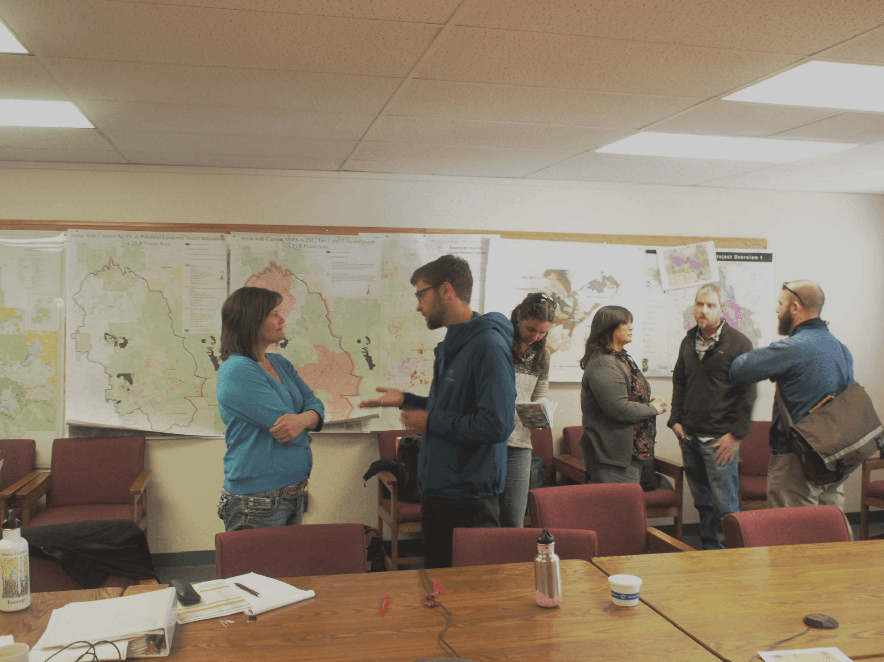
Sierra Institute currently provides facilitation services to the BHCCFWG and has been involved with the group since 2009. Facilitation, at a basic level, involves handling meeting logistics like agenda development, meeting minutes, and directing meeting flow. Sierra Institute’s role extends beyond these fundamental activities to guide members towards decisions that support the group’s founding principles and vision.
The BHCCFWG is also an original participant in Sierra Institute’s Sierra to California All-Lands Enhancement (SCALE) effort, which is a mechanism that brings together collaborative forestry groups in California to share experiences, advance common goals, and increase the pace and scale of restoration. Visit the SCALE website for more information.
Featured Projects

Lower Hat Creek Restoration
The Lower Hat Creek project included assessment, planning, and design to restore streambanks and aquatic habitat along the Hat Creek, upstream of the bridge over Hwy 299. Eroding stream banks and a large sediment slug was degrading habitat in this area and threatening cultural resources. (Photo and Project Info: Fall River RCD)

Burney Gardens
The Burney Gardens project was initiated by four industrial timberland owners and other partners to create a single comprehensive plan for 2,500 acres of meadow restoration. The plan led to the treatment of the degraded meadow system, involving timber harvests and watershed restoration work. (Photo and Project Info: Fall River RCD)
Resources
November 2021 Meeting Notes